Skibbereen to Mizen Head on the Wild Atlantic Way
We pick up on our next leg of the Wild Atlantic Way - travelling from Skibbereen to Mizen Head in County Cork - after leaving Cape Clear behind us. This leg feels like "home territory" for me as I know the area well - my own family of Collins' came from outside the village of Ballydehob.
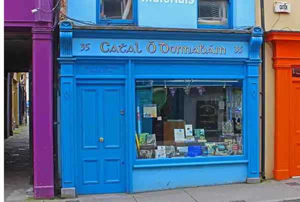
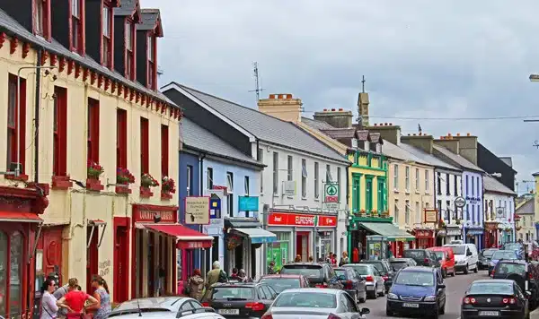
Skibbereen always presents a bright and cheerful face, specially on a sunny weekend. It’s the sort of town that I like to wander around – nipping into a coffee shop for a chat and a catchup – or wandering around some of the back lanes and roads.
There is also a very good Heritage Centre in the town. Someday I must hop on a boat in Baltimore and sail up the river Ilen to the middle of the town – that would be a nice trip.
As you wander around the town, you’ll see lots of names over the shops and pubs that are found in quantity all over West Cork. This area would have been under the control of the O’Driscolls, McCarthys and O’Mahonys a few centuries back – with plenty of Crowleys, Learys, O’Donovans and Hurleys added to the mix a little later.
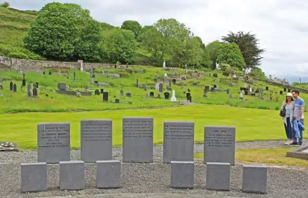
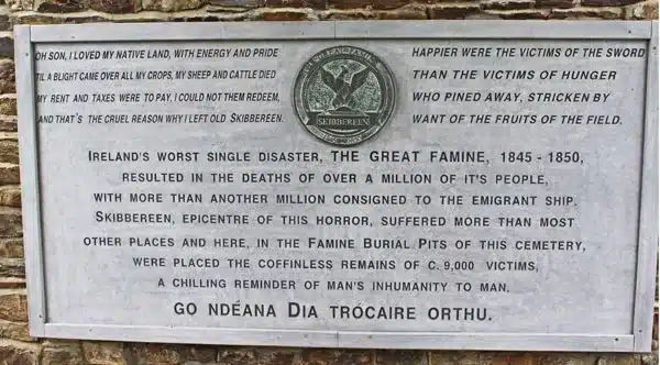
As we left the town, we made our way to Abbeystowery Graveyard. Skibbereen was one of the worst-affected areas in Ireland during the famine – and the memorial in this place reflect those facts.
This is a Famine memorial at Abbeystrewery graveyard. The young man on the right (my son) has family buried there from his great-great grandparents back.
But that’s not the thing.
The thing is that there are about 9000 bodies buried during the mid-1800s in a mass grave in the small green plot behind the standing stones you see. Many of them were probably ancestors of the young man – and some may even be ancestors of yours.
It does make you stop and think alright.
If you look in the census for 1901 for the area around Skibbereen, you’ll find the following surnames in quantity:
Barnett, Barry, Bohane, Burke, Cadogan, Cahalane, Canty, Carey, Casey, Caverly, Coakley, Coghlan, Collins, Connell, Connolly, Cotter, Coughlan, Cronin, Crowley, Cunningham, Daly, Donoghue, Duggan, Fitzgerald, Geaney, Harrington, Hayes, Hegarty, Holland, Hourihane, Hurley, Keating, Keohane, Kingston, Levis, Lynch, Lyons, McCarthy, Mahony, Minihane, Murphy, Neill, O’Brien, O’Driscoll, O’Donovan, O’Callaghan, O’Leary, O’Shea, Regan, Roycroft, Salter, Sheehy, Sullivan, Swanton, Walsh, Wholey, Wolfe, Young.
Are any of your Irish surnames here?
Ballydehob and Schull.
Ten miles to the west of Skibbereen, we arrived in the colourful village of Ballydehob. Sometimes the “Bally” at the beginning of an Irish placename comes from “Baile” – meaning town or home – and sometimes it comes from “Béal” – meaning mouth. In this case, the Irish for Ballydehob is “Béal an Dhá Chab” or “mouth of the two river fords”.
I actually managed to get a picture of ALL of the twelve arches of the old railway bridge. No mean feat!
As we proceed towards Schull the countryside gets even rockier. We could have travelled by boat at high tide in this lovely part of Roaringwater Bay – but a lazy car journey is no mean feat either.
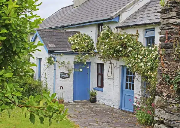
This road starts to get nice and spectacular – the looming Mount Gabriel to your right and the shimmering sea to your left. Lots of old homesteads and cottages dot the landscape in between.
At this point we are entering territory that was ruled over a branch of the O’Mahonys many centuries ago – and we make our way towards Ireland’s most southwesterly point – Mizen Head.
The modern day population is getting sparser – but if you look in the census for 1901 for the area around this part of the Mizen Peninsula, you’ll find the following surnames in quantity:
Ahern, Carey, Collins, Cotter, Coughlan, Daly, Donovan, Doyle, Driscoll, Fitzgerald, Foley, Godsil, Goggin, Griffin, Hayes, Hegarty, Hennessy, Hurley, Keeffe, Leary, McCarthy, Mahony, Murphy ,Neville, Newman, O’Brien, Regan, Reilly, Scully, Sheehan, Sullivan, Treacy, Walsh, Whooley, Willis, Woods.
Are any of your Irish surnames here?
Mizen Head.
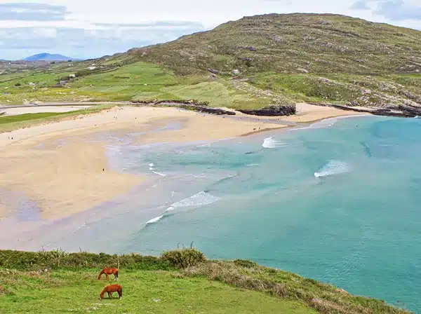
We were getting closer to the end of the peninsula – there seemed to be as much sea as land around us. One of the nicest beaches in Ireland has to be Barley Cove – and for some reason the sun seems to shine here more than the rest of the County – a nice bonus!
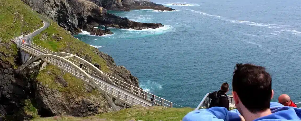
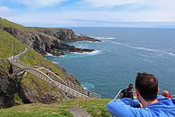
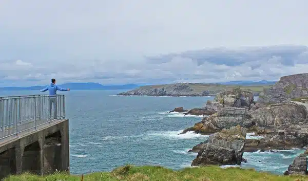
Along a last narrow road for a few miles we came to the Mizen Head Centre. Reopened about 3 years and offering easy(ish) access to some spectacular scenery. When you’re not admiring the view all around, there is a great story told about the life of the local light-house keepers.
There is also something about the quality of the light and sea around here. There seems to be a different view every time I come as the light patterns change against the dramatic cliffs.
And of course – there is always that photo-opportunity for your own “Titanic Moment” at the end of the viewing platforms.
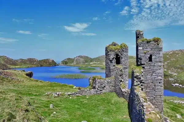
Just a couple of miles up the road (and across a couple of fields) lie the spectacular ruins of an old O’Mahony fort. This area is known as “Three Castle Head” and the castle is Dunlough castle. The castle ruins sit in a small valley at the edge of a lake – which in turn almost spills out over the nearby cliffs into the wild atlantic.
This Castle was the point of final defence for the O’Mahonys. In the 1200s they had much greater lands through Cork, but were driven further and further west – here to the tip of the Mizen Peninsula by the McCarthys and the invading Normans.
Well, that wraps up this leg of our trip around Ireland’s Wild Atalntic Way. Join us next time as we travel from the village of Durrus, all around the Sheeps Head Peninsula and back into the historic town of Bantry.
And remember, feel free to leave your questions and comments below.



Only Plus Members can comment - Join Now
If you already have an account sign in here.